


Breezy and cool conditions likely Wednesday
MACON, Georgia (41NBC/WMGT) – Winds will shift to the northwest overnight Tuesday, bringing cooler weather to Middle Georgia Wednesday.
The Rest of the Evening
A few cirrus clouds will linger into tonight, however overnight skies will overall be mostly clear. Temperatures will again drop into the upper 30s and lower 40s ahead of the sunrise tomorrow. Winds will be a bit breezy tonight from the northwest as they come in at 10-15 mph, gusting upwards of 20 mph.
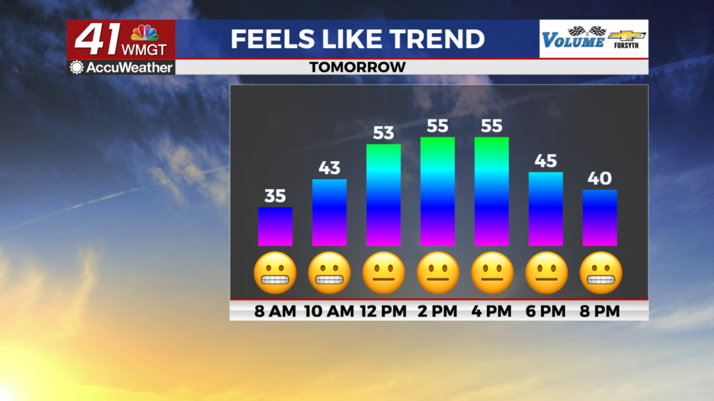
Tomorrow
Mostly sunny skies are likely with temperatures only peaking in the mid to upper 50s. Winds will remain rather strong from the north-northwest at about 7-15 mph, gusting upwards of 25 mph. A light sweater would be a good idea throughout the afternoon for anyone with outdoor plans.


Expect clear skies overnight with northerly winds at around 5 mph. Temperatures will likely drop below freezing for much of the region ahead of Thursday morning.
Thursday and Beyond
High pressure will move through the region Thursday as sunny skies stick around. Once that high clears the region by passing to the east, the winds will shift towards the south. This will allow moisture to return ahead of the weekend. Expect partly cloudy skies both Friday and Saturday with some showers possible late on Saturday. Thunderstorm odds look pretty good for Sunday afternoon/evening at this time as another cold front passes through the Southeastern US.

Follow Meteorologist Aaron Lowery on Facebook (Aaron Lowery 41NBC) and Twitter (@ALowWX) for weather updates throughout the day. Also, you can watch his forecasts Monday through Friday on 41NBC News at 4, 5, 5:30, 6, and 11 PM.

