Cloud cover ramps up overnight; wet pattern ahead
MACON, Georgia (41NBC/WMGT) – Cloud cover is increasing as a low pressure system in the gulf continues to move east-northeast towards Georgia.
Overnight


Cloud cover over Middle Georgia will thicken, trapping more heat from the afternoon near the surface. Temperatures by tomorrow morning will be in the upper 50s for most of the region. Overnight winds will calm and shift towards the south. No rain is anticipated.
Tomorrow


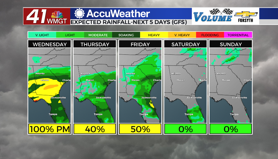
While Wednesday will be a gloomy day the rain will hold off until the later hours. Temperatures will climb into the mid to upper 70s with winds out of the south at around 5 mph. Shower activity is likely to begin heading into the suppertime hours, becoming more widespread and heavy as the night draws on.


The calm winds from the afternoon will shift to the east-northeast and increase in intensity by quite a bit, especially in the gusts department. By tomorrow morning sustained speeds will range from 5-15 mph with gusts pushing as high as 30 mph. The heaviest rain is expected in conjunction with these winds heading into tomorrow morning, however it should start to lighten up as the sun rises. Temperatures will be in the lower 60s to begin Thursday. Rain totals will likely range from half an inch to 2.5 inches by Thursday morning.
Thursday and Beyond


While Thursday will see a wet start, conditions will largely calm by lunchtime in regards to rain. The powerful winds, however, are likely to persist through the afternoon. Skies will remain mostly cloudy through Friday before clearing ahead of the weekend. A few showers are likely Friday, however all rain should be gone by Saturday as well.

Follow Meteorologist Aaron Lowery on Facebook (Aaron Lowery 41NBC) and Twitter (@ALowWX) for weather updates throughout the day. Also, you can watch his forecasts Monday through Friday on 41NBC News at Daybreak (5-7 a.m.) and 41Today (11 a.m).