
Work week to end on a gloomy note
MACON, Georgia (41NBC/WMGT) – Cloud cover and scattered showers will remain possible until Saturday morning.
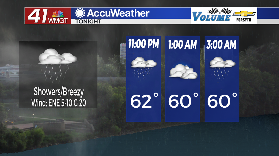
Overnight
Overcast skies will remain with temperatures hanging in the upper 50s and lower 60s. The winds will not be as strong as last night, but gusts could still range from 15-20 mph. Off and on showers will be possible throughout the night and into tomorrow morning, so keep the rain gear handy ahead of Friday.
Tomorrow
Showers will persist through the day and into the overnight hours. Winds will shift more towards the northeast at about 7-12 mph. Gusts could still range from 15-20 mph. High temperatures will reach into the mid to upper 60s with overnight lows expected to largely fall into the lower 60s.
The Weekend
Sunshine will largely return to Middle Georgia save for some scattered clouds Saturday afternoon and wrap-around clouds that fill in Sunday afternoon. Saturday will be warm and breezy with highs in the lower 80s and winds from the west-southwest at 10-15 mph. Sunday will be cooler with highs in the lower 70s and northwest winds at 10-17 mph. Gusts both days could reach as high as 30 mph. Overnight lows will drop into the mid 50s Saturday night and upper 40s Sunday night.

Follow Meteorologist Aaron Lowery on Facebook (Aaron Lowery 41NBC) and Twitter (@ALowWX) for weather updates throughout the day. Also, you can watch his forecasts Monday through Friday on 41NBC News at Daybreak (5-7 a.m.) and 41Today (11 a.m).